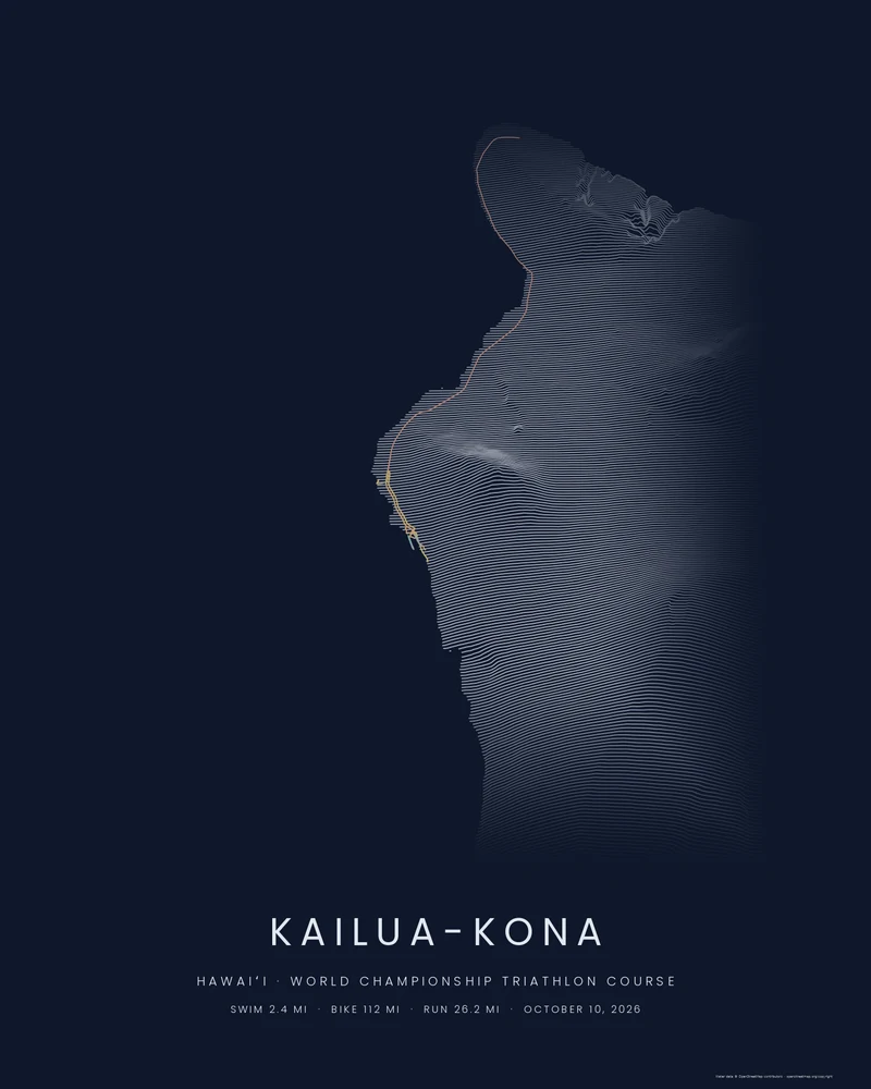
The course that decides triathlon's world championship has barely changed since the race moved to the Island of Hawaiʻi in 1981: a 2.4-mile swim out and back across Kailua Bay, 112 miles on the Queen Kaʻahumanu Highway north through the lava fields to the town of Hāwī and back, then a 26.2-mile run along Aliʻi Drive, up Palani Road and out to the Natural Energy Laboratory before the finish on Aliʻi Drive. On October 10, 2026 the men's and women's races return to Kona on the same day for the first time since 2019.
In the Ridgeline preview the whole course sits on the western slopes of the island: the bike leg runs the length of the frame along the coast, the marathon doubles back on itself north of town, and the swim is a tight loop at the pier. The elevation lines come from public elevation data of the volcanoes behind the road; the course is highlighted on top of them.
The three legs are separate tracks in one bundled file, so in the studio you can hide any leg, change the highlight color, and set the title. For your own race, upload the GPX files your watch recorded instead, or type your splits into the form on the Kona page so they are printed under the course.
- Starting point
- Triathlon course
- Preview style
- Ridgeline
- Poster files
- PNG, PDF and SVG at print resolution
- Model files
- STL, 3MF and GLB, when you choose the 3D terrain model
- Price
- Pay what you want, including free
What you can make from Kona Course
Poster. Keep the Ridgeline preview or switch to another poster style. Set the title, colors and size, then download PNG, PDF or SVG and print it yourself or through a print shop.
3D terrain model. Choose the 3D Terrain Model product to turn the same terrain into a printable relief. Adjust the model size, base and vertical exaggeration, preview it in the browser, then download STL or 3MF for your slicer.
Course. The bundled course is drawn on OpenStreetMap road geometry to follow the organiser's published course maps and appears highlighted on the terrain. Bundled course tracks are artwork drawn on OpenStreetMap road geometry to follow the published course maps. They are not official course files or navigation guidance. Upload your own GPX file to replace it with your recorded race.
Questions about the Kona Course artwork
- Can I put my finishing time on the poster?
- Yes. The Kona page has a form for your name and your swim, bike, run and finish times; it writes them onto the print as the caption. You can also edit the title, subtitle and detail line in the studio at any time.
- Can I use my own race file instead?
- Yes. Upload the GPX file your watch or bike computer recorded, from Garmin, Strava, Wahoo or COROS, and your own line replaces the bundled course. Upload all three legs as one file, or make a separate print for each.
- Is this the official course file?
- No. The bundled track is drawn on OpenStreetMap road geometry to follow the organiser's published 2026 course maps, and checked against them for length and position. Download the official files from the organiser's course page, and never use these for navigation. Printed Canyon has no connection to the race organiser.
- How much does a Kona course poster cost?
- Downloads are pay what you want, including free. You receive print-ready PNG, PDF and SVG files for a poster, or STL, 3MF and GLB for a 3D terrain model, and print them yourself or at a print shop. No account is needed.
See every leg, the Hawaiʻi collection and the race-time caption form on the Kona course page.
Printed Canyon is an independent map-art studio with no connection to the race organiser or any triathlon brand. Course and place names describe where the course goes; the organiser's course page has the official files.
Want the conversion pages instead? See GPX to poster or GPX to STL.