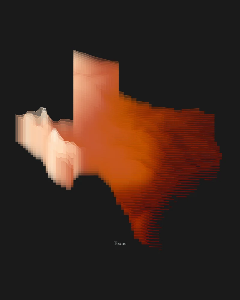
Texas climbs from sea level on the Gulf Coast toward the High Plains and the mountains of the Trans-Pecos. In Central Texas, the Balcones Escarpment runs from the Dallas area past San Antonio toward Del Rio, separating the Hill Country and the Edwards Plateau from the coastal plains to the east, according to the Bureau of Economic Geology.
The National Park Service lists Guadalupe Peak, in Guadalupe Mountains National Park, as the state's highest point at 8,751 feet (2,667 m). In the Strata preview, the western mountains take the lightest bands of the sandstone palette, the Panhandle and central plateaus sit in the middle tones, and the coastal plain falls into deep red.
The preview is the Strata export for Texas with the sandstone palette at 18 × 24 inches. In the creator you can change the palette, background and title, adjust the vertical exaggeration to lift the Hill Country, or switch to Ridgeline, Contours or a 3D terrain model.
- Starting point
- US state
- Boundary
- TX
- Preview style
- Strata
- Poster files
- PNG, PDF and SVG at print resolution
- Model files
- STL, 3MF and GLB, when you choose the 3D terrain model
- Price
- Pay what you want, including free
What you can make from Texas
Poster. Keep the Strata preview or switch to another poster style. Set the title, colors and size, then download PNG, PDF or SVG and print it yourself or through a print shop.
3D terrain model. Choose the 3D Terrain Model product to turn the same state into a printable relief. Adjust the model size, base and vertical exaggeration, preview it in the browser, then download STL or 3MF for your slicer.
Questions about the Texas artwork
- Does the Texas map show the Hill Country?
- As broad color steps rather than sharp peaks. At whole-state scale, the Edwards Plateau and Hill Country sit in the middle tones between the coast and the western mountains. For more detail, search a city such as Austin as a place in the creator.
- Can I make a 3D-printable model of the whole state?
- Yes. Switch the product to 3D Terrain Model in the creator to preview the state as a relief model and download STL, 3MF or GLB. Choose a model size that fits your printer and check the slicer preview before printing.
- How much does it cost?
- Downloads are pay what you want, including free. You can add a contribution at checkout if the artwork or model is worth it to you. No account is needed.
- Do you ship a printed poster or a 3D print?
- No. Printed Canyon delivers digital files only: PNG, PDF and SVG for posters, and STL, 3MF and GLB for terrain models. You print them at home or through a print shop or 3D-printing service of your choice.
Want the conversion pages instead? See GPX to poster or GPX to STL.