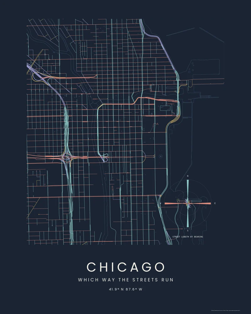
Chicago's streets follow a grid laid out along the township survey lines, so almost every street in the Loop runs north-south or east-west. The Chicago River bends around downtown, and Lake Michigan lines its eastern edge.
The curated map area is about 4 by 5.3 kilometers. The Street Compass preview colors each street by its bearing on a dark ground, and the rose in the corner shows the street length in each direction, two strong spokes for the grid and short ones for the diagonals.
Streets and water come from OpenStreetMap contributors and Overture Maps Foundation. In the creator you can switch to Footprints, Wash or Blueprint, change the bearing colors, or move the area.
- Starting point
- Map area
- Map area
- 41.86°–41.91° N, 87.61°–87.65° W
- Preview style
- City
- Poster files
- PNG, PDF and SVG at print resolution
- Model files
- STL, 3MF and GLB, when you choose the 3D terrain model
- Price
- Pay what you want, including free
What you can make from Chicago
Poster. Keep the City preview or switch to another poster style. Set the title, colors and size, then download PNG, PDF or SVG and print it yourself or through a print shop.
3D terrain model. Choose the 3D Terrain Model product to turn the same terrain into a printable relief. Adjust the model size, base and vertical exaggeration, preview it in the browser, then download STL or 3MF for your slicer.
Questions about the Chicago artwork
- What does the street compass on the Chicago poster show?
- The total length of street running in each direction. In the Loop nearly all of it runs north-south or east-west, so the rose shows two long spokes; diagonal streets such as Milwaukee Avenue add short ones in between.
- Can I 3D print this city instead?
- Yes. Choose 3D Terrain Model in the creator and turn on city features to model the same buildings, streets, water and parks as a printable STL or 3MF, for areas under 5 km across.
- How much does it cost?
- Downloads are pay what you want, including free. You can add a contribution at checkout if the artwork or model is worth it to you. No account is needed.
- Do you ship a printed poster or a 3D print?
- No. Printed Canyon delivers digital files only: PNG, PDF and SVG for posters, and STL, 3MF and GLB for terrain models. You print them at home or through a print shop or 3D-printing service of your choice.
Want the conversion pages instead? See GPX to poster or GPX to STL.