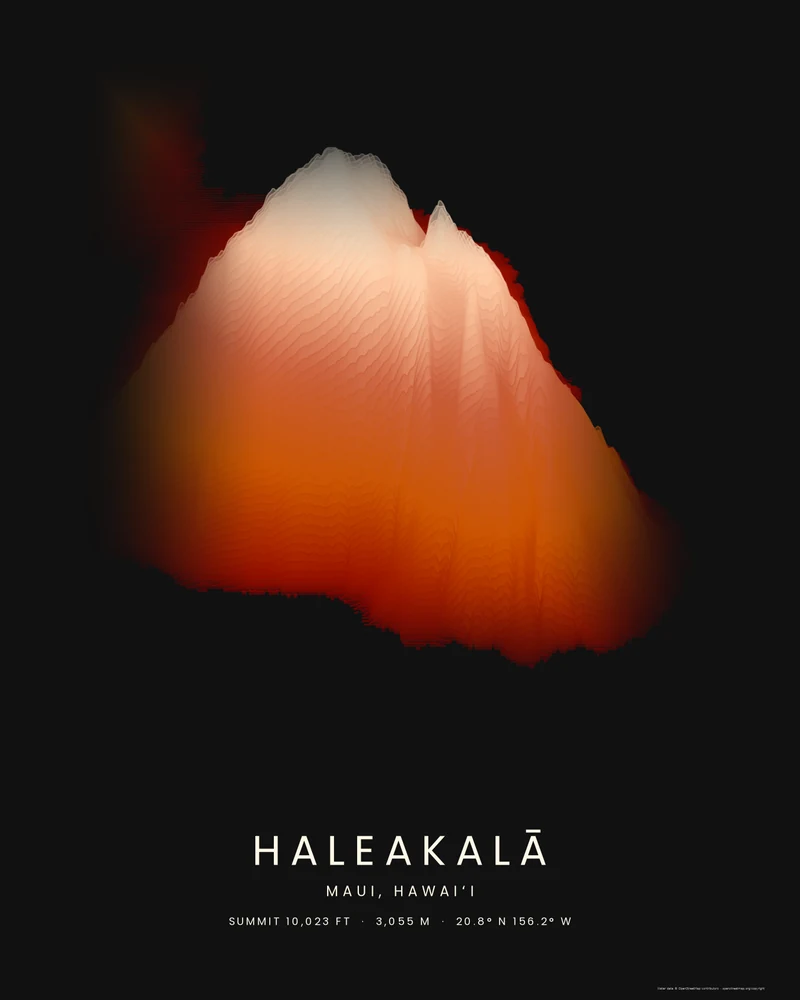
Haleakalā is the shield volcano that makes up about three quarters of Maui. Its summit, Puʻu ʻUlaʻula, stands 10,023 feet (3,055 m) above sea level. The summit depression known as the crater, about 7 miles (11 km) long and 2 miles (3 km) wide, was carved mainly by erosion and then partly refilled by cinder cones and lava flows. The volcano last erupted within roughly the past 600 years, and its summit area is protected in Haleakalā National Park.
The curated map area is about 53 by 43 kilometers and takes in all of East Maui. The frame around the island is mostly ocean, which renders flat, so this preview zooms to 1.15 and pans the camera onto the land. Seen from the south, the volcano climbs in bands from deep rust at the shore to pale sand at the top, with the summit and the rim of the crater breaking the skyline.
The preview is the Strata export at 18 × 24 inches, generated from public elevation data. The creator opens with the same zoom and vertical pan, so you can start from this view, change the palette and title, or switch to Ridgeline or Contours. Choose 3D Terrain Model to download the volcano as a printable STL or 3MF; the download credits the elevation source used.
- Starting point
- Map area
- Map area
- 20.56°–20.95° N, 155.97°–156.48° W
- Preview style
- Strata
- Poster files
- PNG, PDF and SVG at print resolution
- Model files
- STL, 3MF and GLB, when you choose the 3D terrain model
- Price
- Pay what you want, including free
What you can make from Haleakalā
Poster. Keep the Strata preview or switch to another poster style. Set the title, colors and size, then download PNG, PDF or SVG and print it yourself or through a print shop.
3D terrain model. Choose the 3D Terrain Model product to turn the same terrain into a printable relief. Adjust the model size, base and vertical exaggeration, preview it in the browser, then download STL or 3MF for your slicer.
Questions about the Haleakalā artwork
- Does the Haleakalā map include West Maui?
- No. The map area covers East Maui, which is Haleakalā itself. The older West Maui Mountains lie across the isthmus to the northwest; widen the map area in the creator or search for Maui to frame the whole island.
- Can I download this landscape as an STL file?
- Yes. Choose 3D Terrain Model in the creator to turn the same map area into a printable relief model. Download STL or 3MF, open it in your slicer, and check the scale for your printer.
- How much does it cost?
- Downloads are pay what you want, including free. You can add a contribution at checkout if the artwork or model is worth it to you. No account is needed.
- Do you ship a printed poster or a 3D print?
- No. Printed Canyon delivers digital files only: PNG, PDF and SVG for posters, and STL, 3MF and GLB for terrain models. You print them at home or through a print shop or 3D-printing service of your choice.
Want the conversion pages instead? See GPX to poster or GPX to STL.