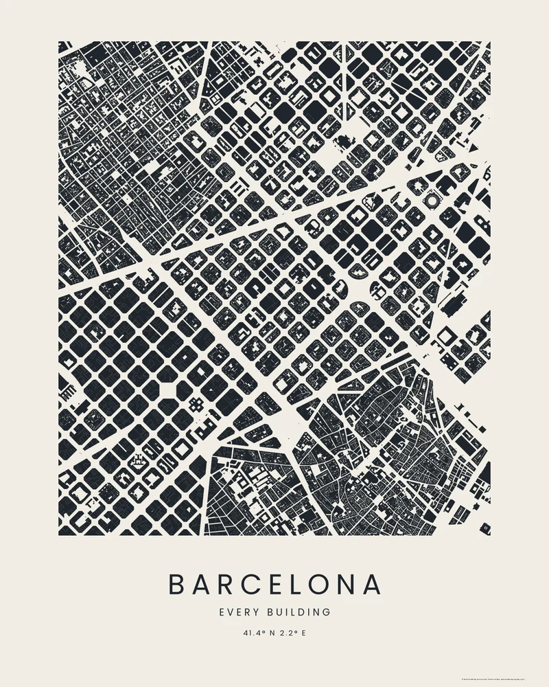
The Eixample, Barcelona's 19th-century extension, was planned by Ildefons Cerdà as a grid of square blocks with cut corners, the chamfers that turn each crossing into a small plaza. Avinguda Diagonal crosses it at an angle, and Gaudí's Sagrada Família fills one block near its north-east edge.
The curated map area is about 2.4 by 3.2 kilometers. The Footprints preview fills each building in ink on paper and leaves the streets blank, so the grid reads from the courtyards inside the blocks and the octagonal crossings between them.
Building footprints come from OpenStreetMap contributors and Overture Maps Foundation. In the creator you can switch to Wash, Blueprint or Street Compass, add streets, water and parks, change every color, or move the area.
- Starting point
- Map area
- Map area
- 41.38°–41.41° N, 2.15°–2.18° E
- Preview style
- City
- Poster files
- PNG, PDF and SVG at print resolution
- Model files
- STL, 3MF and GLB, when you choose the 3D terrain model
- Price
- Pay what you want, including free
What you can make from Barcelona
Poster. Keep the City preview or switch to another poster style. Set the title, colors and size, then download PNG, PDF or SVG and print it yourself or through a print shop.
3D terrain model. Choose the 3D Terrain Model product to turn the same terrain into a printable relief. Adjust the model size, base and vertical exaggeration, preview it in the browser, then download STL or 3MF for your slicer.
Questions about the Barcelona artwork
- Why do the Eixample's blocks have cut corners?
- Cerdà chamfered every block so that carts and later trams could turn and see along both streets, and so that each crossing opened into a small square. On the poster the cut corners make each intersection an octagon of white space.
- Can I make a City poster of my own neighborhood?
- Yes. Search any place in the creator and choose City, then frame an area up to 10 km across. Where buildings are mapped, every footprint is drawn; you can upload a GPX file to draw a run or walk through the streets.
- How much does it cost?
- Downloads are pay what you want, including free. You can add a contribution at checkout if the artwork or model is worth it to you. No account is needed.
- Do you ship a printed poster or a 3D print?
- No. Printed Canyon delivers digital files only: PNG, PDF and SVG for posters, and STL, 3MF and GLB for terrain models. You print them at home or through a print shop or 3D-printing service of your choice.
Want the conversion pages instead? See GPX to poster or GPX to STL.