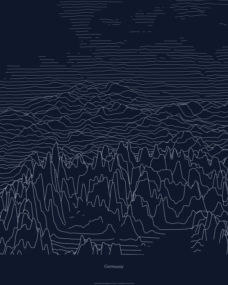
Germany rises from the North German Plain through the central uplands and the south-west German scarplands to the Alpine foreland and the Bavarian Alps, as the Federal Statistical Office describes it. The highest point is the Zugspitze at 2,962 meters; the lowest land point, near Neuendorf-Sachsenbande in Schleswig-Holstein, lies about 3.5 meters below sea level.
The curated map area is a rectangle around the country, not the national border, so parts of every neighboring country are inside the frame. In the Ridgeline preview, the Alps rise as sharp peaks along the bottom, the uplands roll across the middle, and the lines flatten across the northern plain toward the sea.
The preview is the Ridgeline export for this map area, generated from public global elevation data. In the creator you can change line density, perspective, colors and title, switch to Strata or Contours, or frame one region instead. Choose 3D Terrain Model to download a printable STL or 3MF; outside the United States, models use Copernicus DEM GLO-30 elevation data.
- Starting point
- Map area
- Map area
- 47.20°–55.10° N, 5.80°–15.10° E
- Preview style
- Ridgeline
- Poster files
- PNG, PDF and SVG at print resolution
- Model files
- STL, 3MF and GLB, when you choose the 3D terrain model
- Price
- Pay what you want, including free
What you can make from Germany
Poster. Keep the Ridgeline preview or switch to another poster style. Set the title, colors and size, then download PNG, PDF or SVG and print it yourself or through a print shop.
3D terrain model. Choose the 3D Terrain Model product to turn the same terrain into a printable relief. Adjust the model size, base and vertical exaggeration, preview it in the browser, then download STL or 3MF for your slicer.
Questions about the Germany artwork
- Is the Germany map cut to the national border?
- No. The map area is a rectangle, so border regions of neighboring countries appear around Germany. Border outlines are available only for US states.
- Can I download this landscape as an STL file?
- Yes. Choose 3D Terrain Model in the creator to turn the same map area into a printable relief model. Download STL or 3MF, open it in your slicer, and check the scale for your printer.
- How much does it cost?
- Downloads are pay what you want, including free. You can add a contribution at checkout if the artwork or model is worth it to you. No account is needed.
- Do you ship a printed poster or a 3D print?
- No. Printed Canyon delivers digital files only: PNG, PDF and SVG for posters, and STL, 3MF and GLB for terrain models. You print them at home or through a print shop or 3D-printing service of your choice.
Want the conversion pages instead? See GPX to poster or GPX to STL.