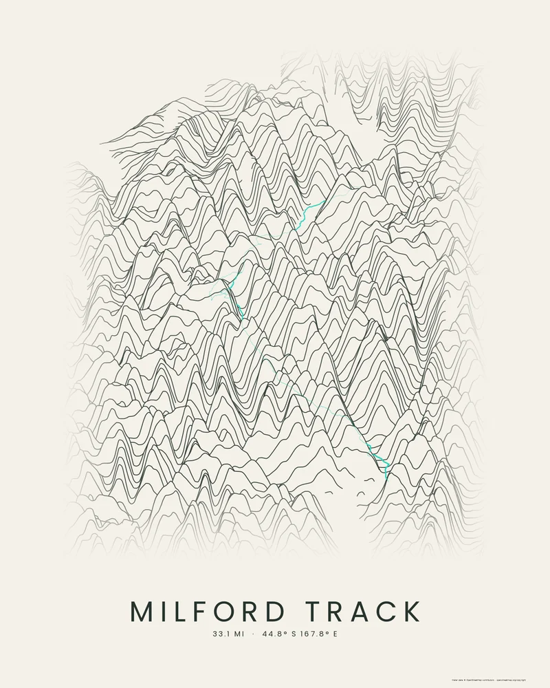
The Milford Track is one of New Zealand's Great Walks, 53.5 kilometers (33 miles) through Fiordland National Park. It starts at Glade Wharf at the head of Lake Te Anau, follows the Clinton valley up to Mackinnon Pass at 1,154 meters (3,786 feet), passes the side trip to Sutherland Falls, and descends the Arthur valley to Sandfly Point on Milford Sound. It is walked in one direction over four days.
The bundled track is joined from the OpenStreetMap hiking route relation for the Milford Track, © OpenStreetMap contributors under the Open Database License. In the Ridgeline preview, the route runs up one valley and down the next, crossing the range at Mackinnon Pass between them.
The track is artwork, not navigation guidance. In the Great Walks season, the Department of Conservation requires hut bookings, and walkers keep to a set itinerary. In the creator you can change line density, perspective, highlight color and title, or switch to Contours or Strata, and choose 3D Terrain Model to emboss the route on a printable model; the download credits the elevation source used.
- Starting point
- OpenStreetMap hiking route
- Preview style
- Ridgeline
- Poster files
- PNG, PDF and SVG at print resolution
- Model files
- STL, 3MF and GLB, when you choose the 3D terrain model
- Price
- Pay what you want, including free
What you can make from Milford Track
Poster. Keep the Ridgeline preview or switch to another poster style. Set the title, colors and size, then download PNG, PDF or SVG and print it yourself or through a print shop.
3D terrain model. Choose the 3D Terrain Model product to turn the same terrain into a printable relief. Adjust the model size, base and vertical exaggeration, preview it in the browser, then download STL or 3MF for your slicer.
Route. The bundled trail is an OpenStreetMap hiking route, joined into one track and highlighted on the terrain. Bundled routes are artwork inputs, not navigation guidance. Upload your own GPX file to replace it with your recorded hike.
Questions about the Milford Track artwork
- Do I need to book the Milford Track?
- Yes, in the Great Walks season. The Department of Conservation sells hut bookings, which fill quickly, and walkers follow a fixed four-day itinerary. Check the Department of Conservation's Milford Track page before you plan; this poster is artwork, not trip guidance.
- Can I use my own hike instead of the bundled route?
- Yes. Upload a GPX file from Strava, AllTrails, Garmin or another service and your recorded track replaces the bundled one. The bundled track is joined from an OpenStreetMap hiking route, © OpenStreetMap contributors under the Open Database License, and it is artwork, not navigation guidance.
- Can I 3D print this trail as a terrain model?
- Yes. In the creator, switch the product to 3D Terrain Model. The route is embossed on the surrounding terrain, and you can adjust the model size, terrain extent and vertical exaggeration before downloading STL or 3MF.
- How much does it cost?
- Downloads are pay what you want, including free. You can add a contribution at checkout if the artwork or model is worth it to you. No account is needed.
Want the conversion pages instead? See GPX to poster or GPX to STL.