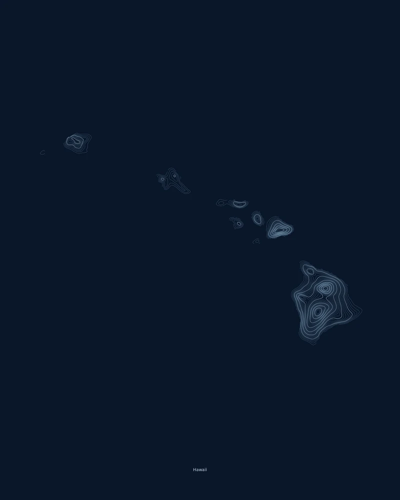
Each Hawaiian island is the top of one or more volcanoes. The Island of Hawaiʻi, the youngest and largest, is built from five, including Mauna Kea, Mauna Loa and Kīlauea, one of the most active volcanoes on Earth. Haleakalā forms the eastern part of Maui, and the islands grow older and more eroded to the northwest toward Kauaʻi and Niʻihau.
Mauna Kea is the highest point at 13,803 feet (4,207 m), and the Pacific Ocean is the lowest, at sea level. In the Contours preview, the Island of Hawaiʻi fills the lower right with wide sets of rings around its summits, Haleakalā shows as a tight oval on Maui, and the older islands to the northwest carry smaller, lower clusters of lines.
The preview is the Contours export for the main Hawaiian Islands at 18 × 24 inches. The state outline leaves out the Northwestern Hawaiian Islands, which would stretch the map across more than 1,000 miles of ocean and shrink the main islands to specks. In the creator you can change the contour interval, colors and title, or switch to Ridgeline, Strata or a 3D terrain model.
- Starting point
- US state
- Boundary
- HI
- Preview style
- Contours
- Poster files
- PNG, PDF and SVG at print resolution
- Model files
- STL, 3MF and GLB, when you choose the 3D terrain model
- Price
- Pay what you want, including free
What you can make from Hawaii
Poster. Keep the Contours preview or switch to another poster style. Set the title, colors and size, then download PNG, PDF or SVG and print it yourself or through a print shop.
3D terrain model. Choose the 3D Terrain Model product to turn the same state into a printable relief. Adjust the model size, base and vertical exaggeration, preview it in the browser, then download STL or 3MF for your slicer.
Questions about the Hawaii artwork
- Can I make a map of a single Hawaiian island?
- Yes. The state page shows every main island, so each one is small on the poster. Search a place such as Maui, Kauaʻi or Hawaiʻi Volcanoes National Park in the creator to fill the frame with one island.
- Can I make a 3D-printable model of the whole state?
- Yes. Switch the product to 3D Terrain Model in the creator to preview the state as a relief model and download STL, 3MF or GLB. Choose a model size that fits your printer and check the slicer preview before printing.
- How much does it cost?
- Downloads are pay what you want, including free. You can add a contribution at checkout if the artwork or model is worth it to you. No account is needed.
- Do you ship a printed poster or a 3D print?
- No. Printed Canyon delivers digital files only: PNG, PDF and SVG for posters, and STL, 3MF and GLB for terrain models. You print them at home or through a print shop or 3D-printing service of your choice.
Want the conversion pages instead? See GPX to poster or GPX to STL.