City Map Poster: Every Building and Street, Four Styles
Choose a neighborhood and Printed Canyon draws every building footprint and street in it, ready to print. Pick one of four styles, set the colors, then download PNG, PDF or SVG.
Pay what you want. Digital files. No account.
Four styles, one street map
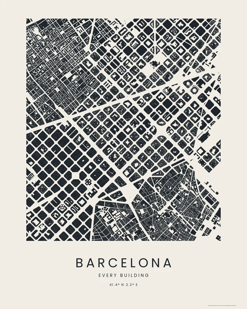
Footprints
Every building filled in ink on paper, the streets left as white space.
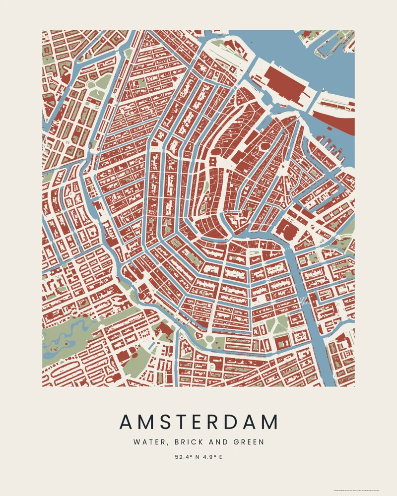
Wash
Water in blue, buildings in brick and parks in green, like a watercolor plan.
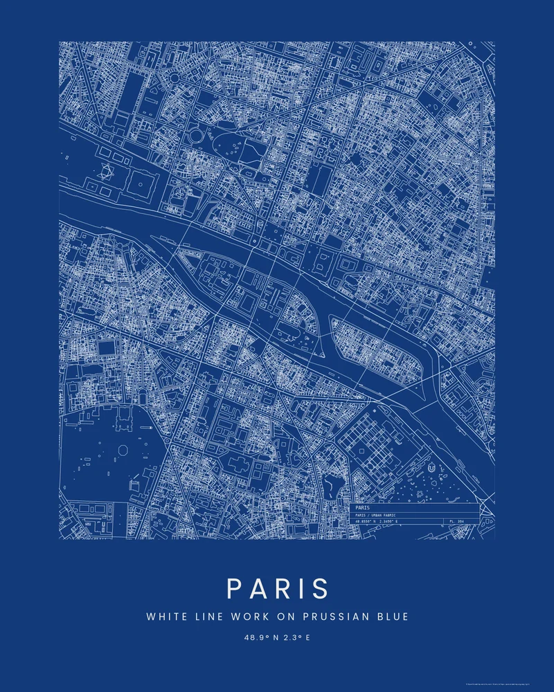
Blueprint
Buildings, streets and riverbanks in white line on Prussian blue, with a title block.
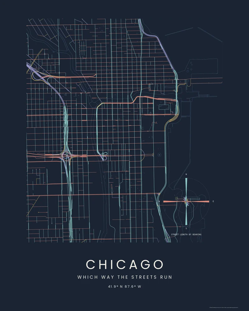
Street Compass
Every street colored by the way it runs, with a rose of the city's bearings.
See the examples as place pages: Barcelona, Amsterdam, Paris and Chicago.
Make a city map poster in four steps
- Step 1
Choose the area
Search for a city or a neighborhood, or enter coordinates, then frame an area up to 10 km across. Upload a GPX file instead to draw a run or a walk through the streets.
- Step 2
Pick City and a style
Choose the City poster, then Footprints, Wash, Blueprint or Street Compass. The preview draws the buildings, streets, water and parks of your area in that style.
- Step 3
Make it yours
Turn each layer on or off, outline or fill the buildings, choose how many streets to show, set every color and the title, or move the compass rose and title block.
- Step 4
Download
Generate the poster and download PNG, PDF and SVG at 12 × 16, 18 × 24 or 24 × 36 inches. Name your price at checkout; $0 is accepted.
Drawn from open map data
Buildings, streets, water and parks come from OpenStreetMap contributors and Overture Maps Foundation, and every download credits them. Coverage is excellent in most city centers and thinner where fewer buildings have been mapped.
Want the city as a 3D print? See the 3D printed city map. For the landscape around it, try the contour map generator.
City map poster questions
Is the city map poster free?
You can download for $0. Printed Canyon is pay what you want, so paying is optional, and you do not need an account.
Where do the buildings and streets come from?
From OpenStreetMap contributors and Overture Maps Foundation, open map data that covers cities worldwide. Where a building has not been mapped, it does not appear on the poster.
How large an area can a city poster show?
Up to 10 km across. A neighborhood or a city center of a few kilometers shows every building clearly; larger areas turn the streets into a fine texture.
What does the street compass show?
A rose of the total street length running in each direction, colored like the streets themselves. A grid city such as Chicago shows two long spokes; an old European center spreads in every direction.
Can I make a 3D city model instead?
Yes. Choose 3D Terrain Model in the creator and turn on city features to model the same buildings, streets, water and parks as a printable STL or 3MF, for areas under 5 km across.