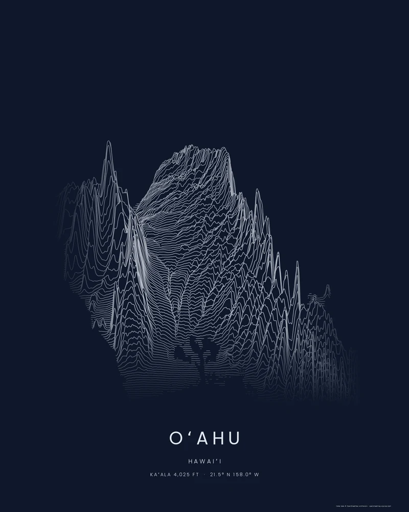
Oʻahu is built from two shield volcanoes, now eroded into the island's two mountain ranges. The older Waiʻanae Range runs along the west side and holds the highest point on the island, Kaʻala, at 4,025 feet (1,227 m). The Koʻolau Range runs along the windward east side, where erosion has left steep, fluted cliffs above Kāneʻohe and Kailua. The central plateau lies between them, and Honolulu, Pearl Harbor and Diamond Head line the southern shore.
The curated map area covers the whole island, about 70 by 54 kilometers. Most of the frame is ocean, which Ridgeline leaves blank, so this preview zooms to 1.1 and pans the camera onto the land. The Waiʻanae Range rises in sharp spikes on the left, the long Koʻolau ridge runs diagonally across the right, and the lines flatten across the plateau between them.
The preview is the Ridgeline export for this map area, generated from public elevation data. The creator opens with the same zoom and pan, so you can start from this view, change line density, perspective, colors and title, or switch to Strata or Contours. Choose 3D Terrain Model to download the island as a printable STL or 3MF; the download credits the elevation source used.
- Starting point
- Map area
- Map area
- 21.24°–21.73° N, 157.63°–158.30° W
- Preview style
- Ridgeline
- Poster files
- PNG, PDF and SVG at print resolution
- Model files
- STL, 3MF and GLB, when you choose the 3D terrain model
- Price
- Pay what you want, including free
What you can make from Oʻahu
Poster. Keep the Ridgeline preview or switch to another poster style. Set the title, colors and size, then download PNG, PDF or SVG and print it yourself or through a print shop.
3D terrain model. Choose the 3D Terrain Model product to turn the same terrain into a printable relief. Adjust the model size, base and vertical exaggeration, preview it in the browser, then download STL or 3MF for your slicer.
Questions about the Oʻahu artwork
- Can I add a hike on Oʻahu to the poster?
- Yes. Upload a GPX file of a hike you recorded, such as the Diamond Head summit trail or a Koʻolau ridge hike, and the creator draws it on the island. To frame one part of Oʻahu, search for a place or draw your own area. The artwork is not navigation guidance.
- Can I download this landscape as an STL file?
- Yes. Choose 3D Terrain Model in the creator to turn the same map area into a printable relief model. Download STL or 3MF, open it in your slicer, and check the scale for your printer.
- How much does it cost?
- Downloads are pay what you want, including free. You can add a contribution at checkout if the artwork or model is worth it to you. No account is needed.
- Do you ship a printed poster or a 3D print?
- No. Printed Canyon delivers digital files only: PNG, PDF and SVG for posters, and STL, 3MF and GLB for terrain models. You print them at home or through a print shop or 3D-printing service of your choice.
Want the conversion pages instead? See GPX to poster or GPX to STL.