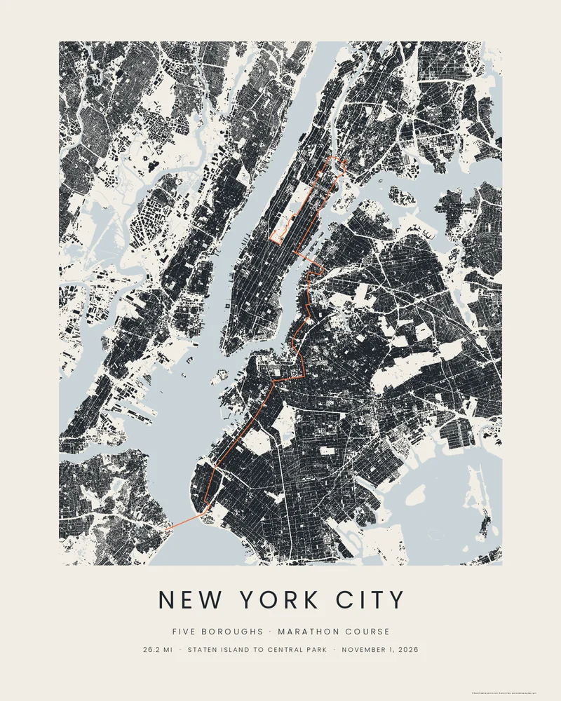
The course starts at Fort Wadsworth on Staten Island, climbs the Verrazzano-Narrows Bridge, and runs the length of Fourth Avenue and on through Williamsburg and Greenpoint before the Pulaski Bridge marks halfway. A short pass through Long Island City leads to the silent climb of the Queensboro Bridge, then First Avenue, the Willis Avenue Bridge into the Bronx, the Madison Avenue Bridge back into Harlem, Fifth Avenue, and the finish on West Drive in Central Park. The 2026 race, the fiftieth to run through all five boroughs, is the first in fifteen years to change the course: a new, straighter line through Mott Haven in the Bronx.
The Footprints preview fills every building in the city in ink: Manhattan's grid, the brownstone blocks of Brooklyn, the rowhouses of Queens and the Bronx, the piers and the parks left as paper. The course cuts through it in orange. The rivers and the harbour are drawn in pale water, which is how the five boroughs read at this scale.
In the studio you can switch to Wash, Blueprint or Street Compass, change every colour and the line weight, or make a 3D city model of the whole course with the buildings, water and parks as separate parts. Type your name and finish time on the NYC Marathon page and they are printed under the course.
- Starting point
- Marathon course
- Preview style
- City
- Poster files
- PNG, PDF and SVG at print resolution
- Model files
- STL, 3MF and GLB, when you choose the 3D terrain model
- Price
- Pay what you want, including free
What you can make from New York City Marathon
Poster. Keep the City preview or switch to another poster style. Set the title, colors and size, then download PNG, PDF or SVG and print it yourself or through a print shop.
3D terrain model. Choose the 3D Terrain Model product to turn the same terrain into a printable relief. Adjust the model size, base and vertical exaggeration, preview it in the browser, then download STL or 3MF for your slicer.
Course. The bundled course follows the organiser's published 2026 course and is drawn through the city's buildings and streets. The bundled course is the published 2026 course as traced by an independent runner's guide, bundled unchanged and checked against the announced route. It is artwork, not an official course file or navigation guidance. Upload your own GPX file to replace it with your recorded race.
Questions about the New York City Marathon artwork
- How long is the New York City Marathon course?
- 26.2 miles, 42.195 km, from Fort Wadsworth on Staten Island to the finish in Central Park, crossing five bridges and all five boroughs. The bundled trace follows the road centrelines and measures 42.6 km, a little longer than the certified line.
- Can I put my finishing time on the poster?
- Yes. The NYC Marathon page has a form for your name, your half split and your finish time; it writes them onto the print as the caption. You can also edit the title, subtitle and detail line in the studio at any time.
- Can I 3D print the whole course with the buildings?
- Yes. Choose 3D Terrain Model in the creator and turn on city features. The whole course is modelled on one base with the rivers, the parks, the expressways and the city's blocks, each block a crisp slab at the height of its tallest building, so Midtown and Downtown rise beside the course on First Avenue. Download STL or 3MF; the 3MF names each part so blocks, water and the course can take their own filament.
- Can I use my own race file instead?
- Yes. Upload the GPX file your watch recorded, from Garmin, Strava, COROS or Apple Watch, and your own line replaces the bundled course, including the start you ran and any detour to a toilet. The caption fields work the same way.
- Is this the official course file?
- No. The organiser publishes the course as a map, not as a GPX file. The bundled track is the 2026 course as published by an independent runner's guide, bundled unchanged and checked against the announced route, including the new Bronx streets. Use it for art, never for navigation. Printed Canyon has no connection to the race organiser.
- How much does it cost?
- Downloads are pay what you want, including free. You can add a contribution at checkout if the artwork or model is worth it to you. No account is needed.
See every City style, the 3D city model and the finish-time caption form on the NYC Marathon page.
Printed Canyon is an independent map-art studio with no connection to the race organiser or its sponsors. The race name describes the course drawn here; the organiser's course page has the official map.
Print the city with its buildings in 3D printed city maps.
Related tools: 3D printed maps, 3D printed topographic maps, the contour map generator, GPX to poster and GPX to STL.